


Sandoval County Precinct 28, Sandoval County, New Mexico
About
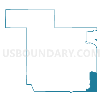
Outline

Summary
| Unique Area Identifier | 623963 |
| Name | Sandoval County Precinct 28 |
| County | Sandoval County |
| State | New Mexico |
| Area (square miles) | 103.92 |
| Land Area (square miles) | 103.92 |
| Water Area (square miles) | 0.00 |
| % of Land Area | 100.00 |
| % of Water Area | 0.00 |
| Latitude of the Internal Point | 35.32794720 |
| Longtitude of the Internal Point | -106.30588040 |
Maps


Graphs
Select a template below for downloading or customizing gragh for Sandoval County Precinct 28, Sandoval County, New Mexico


Neighbors
Neighoring Voting District (by Name) Neighboring Voting District on the Map
- Bernalillo County Precinct 556, Bernalillo County, NM
- Bernalillo County Precinct 559, Bernalillo County, NM
- Bernalillo County Precinct 573, Bernalillo County, NM
- Sandoval County Precinct 20, Sandoval County, NM
- Sandoval County Precinct 29, Sandoval County, NM
- Sandoval County Precinct 56, Sandoval County, NM
- Sandoval County Precinct 77, Sandoval County, NM
- Sandoval County Precinct 9, Sandoval County, NM
- Santa Fe County Precinct 15, Santa Fe County, NM
- Santa Fe County Precinct 16, Santa Fe County, NM
- Santa Fe County Precinct 72, Santa Fe County, NM
Top 10 Neighboring County Subdivision (by Population) Neighboring County Subdivision on the Map
- Rio Rancho CCD, Sandoval County, NM (113,761)
- Santa Fe South CCD, Santa Fe County, NM (39,958)
- East Bernalillo CCD, Bernalillo County, NM (19,056)
- Santo Domingo-San Felipe CCD, Sandoval County, NM (8,270)
Top 10 Neighboring Place (by Population) Neighboring Place on the Map
Top 10 Neighboring Unified School District (by Population) Neighboring Unified School District on the Map
- Albuquerque Public Schools, NM (667,445)
- Santa Fe Public Schools, NM (118,032)
- Bernalillo Public Schools, NM (24,342)
- Moriarty Municipal Schools, NM (23,044)
Top 10 Neighboring State Legislative District Lower Chamber (by Population) Neighboring State Legislative District Lower Chamber on the Map
- State House District 50, NM (31,808)
- State House District 22, NM (29,758)
- State House District 65, NM (26,930)
Top 10 Neighboring State Legislative District Upper Chamber (by Population) Neighboring State Legislative District Upper Chamber on the Map
- State Senate District 22, NM (60,988)
- State Senate District 39, NM (48,118)
- State Senate District 21, NM (48,064)
- State Senate District 19, NM (45,690)
- State Senate District 8, NM (40,059)
Top 10 Neighboring 111th Congressional District (by Population) Neighboring 111th Congressional District on the Map
Top 10 Neighboring Census Tract (by Population) Neighboring Census Tract on the Map
- Census Tract 111, Sandoval County, NM (6,812)
- Census Tract 103.11, Santa Fe County, NM (4,243)
- Census Tract 9407, Sandoval County, NM (3,578)
- Census Tract 9402, Sandoval County, NM (3,566)
- Census Tract 38.03, Bernalillo County, NM (3,180)
- Census Tract 103.09, Santa Fe County, NM (1,765)
- Census Tract 103.10, Santa Fe County, NM (1,291)
Top 10 Neighboring 5-Digit ZIP Code Tabulation Area (by Population) Neighboring 5-Digit ZIP Code Tabulation Area on the Map
- 87015, NM (13,105)
- 87043, NM (5,052)
- 87047, NM (4,894)
- 87001, NM (3,684)
- 87052, NM (3,182)
- 87010, NM (1,139)